For the last four years, 18th Street Arts Center has partnered with Professor Annette Kim’s Critical Cartography class, which is part of the USC Sol Price School of Public Policy. Students in the class used the oral histories and primary research collected via 18th Street’s Culture Mapping 90404 initiative as a starting point, focusing primarily on histories of displacement, communities of color, and immigrant communities in the Pico Neighborhood of Santa Monica. Conducting their own original research and data analysis in addition, they created narrative Story Maps and videos to tell different facets of these stories. The projects below came out of the Fall 2020 course, and were recreated for publication on 18th Street’s Culture Mapping 90404 site by Samirita Dabade in winter of 2021.
Mapping Black Santa Monica: USC’s Critical Cartography Class
Santa Monica Segregation, Then and Now
By Samuel Ross-Brown
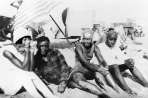
Between 1940 and 1960, Santa Monica’s Pico neighborhood was the site of one of the most vibrant and vital Black communities in Southern California. Anchored by the Ocean Park beach area, one of the few Pacific beaches open to African Americans, Pico was home to jazz clubs, Green Book restaurants, and boarding houses catering to beach-going tourists. In this story map, Samuel Ross-Brown researched the newly transcribed 1940 Census enumeration sheets (released in 2020) to quantify the degree to which Pico and its surroundings were divided by race using spatial autocorrelation analysis.
“Hazards” & Home: Mapping Pico Neighborhood circa 1940
By Penelope Fergison
Based on extensive oral histories from longtime Santa Monica residents Harriette McCauley and Carolyne Edwards (also of the Black history archive Quinn Research Center), as well as correlating research, Penelope Fergison explores why the 90404 Pico Neighborhood was redlined by the HOLC in 1939; and how that designation belied the rich culture and community of the place in the 1940s.
Centered in a Changing Community
By Caelan Rafferty
The Black community in Santa Monica has experienced multiple waves of exodus over its long history, sometimes due to forced displacement, and more recently, because of sky-high property values and gentrification. In this story map, Calaen Rafferty explores the longstanding social groups and community organizations that have managed to weather the change and act as hubs that keep drawing dispersed residents back to Santa Monica. From churches to charity clubs, these spaces provide a social connection that contributes to the endurance of the Black community in Santa Monica.
Broadway: Then & Now
By Anthony Gill
In the popular imagination, Santa Monica––and wider West Los Angeles––is sometimes seen as a largely white, upper- or middle-class community. Indeed, fully two-thirds of Santa Monica residents identify as non-Hispanic white. The hip shops, restaurants, and brand-new apartment buildings of quickly-gentrifying West L.A. and Santa Monica neighborhoods seem to fall in line with this view.
But in the early part of this century, Santa Monica was among the more diverse areas in Los Angeles, and had a thriving Black population with hundreds of residents and numerous Black-owned businesses. A leisure center for L.A. County residents and a hub for working-class jobs, from around 1900 through 1960, African Americans lived originally in the Belmar Triangle area and then in the Pico neighborhood. Anthony Gill explores these important businesses and community anchors, and how they have changed over time.
Down the Street: A Close Look at the Built Environment of the Pico Neighborhood
By Ten Francis
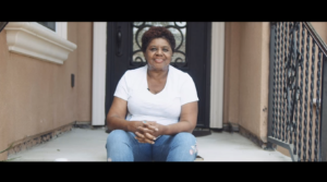
This video by Ten Francis weaves together original interviews from long-time Pico Neighborhood residents, like historian and archivist Carolyne Edwards of the Quinn Research Center, and scenes from the actual neighborhood of then and now. The narrative explores the neighborhood as it once was, and its irrevocable transformation after the construction of the 10 Freeway bisected Pico and displaced thousands of families of color.
More projects coming soon, so please check back often.
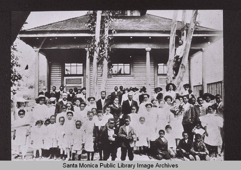
Header image: The original Phillips Chapel Church building at Fourth and Bay Streets in Santa Monica, California with the participants of the Christian Methodist Episcopal Church Sunday School Convention of the Los Angeles District (1909). This was the first building for Phillips Chapel and the CME Church denomination west of Texas. Shown in front are Bishop Charles H. Phillips (center right foreground) and the first pastor, Rev. James A. Stout (left foreground). Santa Monica Public Library Collection